GiaoThong247
8.4
4.1.2
2025-04-11
Latest Version
Social network shares traffic, vehicles and guidance
GiaoThong247 uses offline map to perform the functions of displaying traffic, positioning and instructions. The application runs on Gnam technology platform, a Made in Vietnam technology product developed by TMA. Our ultimate goal is to help the community to minimize traffic jams in urban areas in Vietnam.
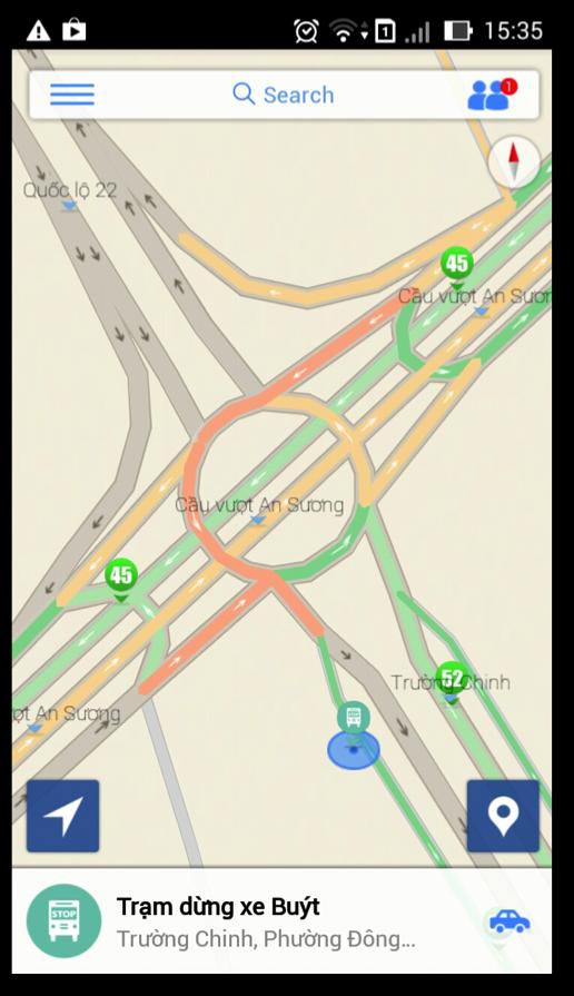
The application has the ability to interact to notify the community of transport events via the internet connection of mobile phones. The application also displays information about traffic directly such as traffic incidents, traffic congestion is happening on the offline number map screen throughout Vietnam.
----------
The main features
- Receive and share traffic information in real time.
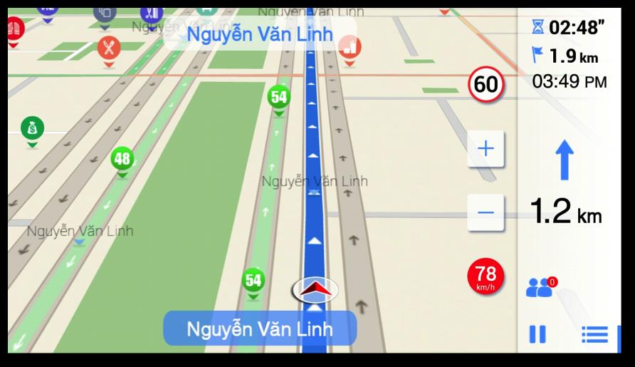
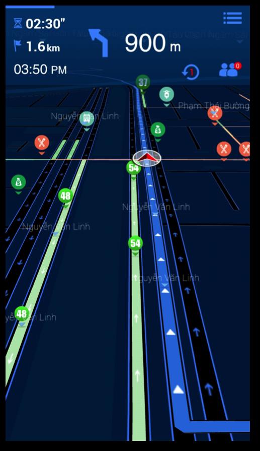
- Positioning and guiding the roadmap by using GPS global positioning system.
- Detailed offline map data in Vietnam (saved on the phone, can be used even when there is no Internet connection).
- Support for 2D/3D navigation.
- The user interface is clear and friendly. Optimize the touch screen, reduce unnecessary operations when finding the way.
- Show the limit speed.
- Search for POI (concern).
- Map is constantly updated.
- Connect and share position with friends on Facebook
----------
Map data source: from OpenStreTmap
Let's contribute to the common map database of the whole community to make their applications better and better!
----------
Traffic data source: From the Gnam project of TMA Solutions
----------
NOTE
- Continuous use of the GPS background feature will significantly reduce the battery life of the device
Let's share information for the green environment for the community!
----------
GiaoThong247 Uses Offline Maps for Traffic Displaying, Positioning and Navigation. The App uses gnam framework, a made in Vietnam Technology from Tma. Our Ultimate Goal is to Contribute to the Community to Help Reducing The Current Heavy Traffic Condition in Vietnam.
Live Information such as Speed, Traffic Incidents, Traffic Jams, Risks Occled on the Streets will be Visualized on Digital Offline Map For The Whole Vietnam.
----------
Main Functions
- Receiving and sharing traffic in real-time.
- Positioning and Navigation using the Global Positioning System GPS.
- Offline Map Map Data Details for the Whole Vietnam (Map data is Store locally on Device and Can be used Even when there is no data connection).
- 2D/3D Navigation.
- Simple and Friendly User Interface that has been Optimized for Touch Screen, and for Easy Navigation Menu.
- On Screen Speed Limited Notification.
- Seaching by Pois.
- Map updated frequently.
- Connect and share location with Friends in Facebook.
----------
Source of map database: OpenStreetmap
Let's Contribute for the Open Public Map To Make Our App Better and Better!
----------
Source of Traffic Data: From Gnam Project - Tma Solutions
----------
Note
- Continued Use of GPS Running in the Background Can Dramatically Decrease Battery Life.
Let's Share information for a Green Community!
Copyright © 2014-2026 downsm.com reserves all rights. | Privacy Policy | DMCA Disclaimer | Terms of Service | Cooking Policy